 Interactive demonstration of online map publishing from our 2013 GIS for Public Gardens: Getting Started workshop.
Our instructor-led training workshops are the best way to learn how to get started with or enhance an existing GIS by using the ArcGIS Public Garden Data Model. We periodically offer stand-alone workshops as well as pre-conference workshops in conjunction with the APGA Annual Conference. Follow one of the Alliance social networks at the bottom of the page to be notified about our next offering in your area.
GIS for Public Gardens: Online & Mobile
June 6, 2016 - APGA Conference, Florida International University, Modesto A. Maidque Campus, Miami, FL
What once was a technology only used in the curators office to put dots on maps has evolved into a complete online and mobile experience that can be used to share information throughout the entire organization and the world. This full-day workshop will guide participants through the process of creating an online and mobile device accessible public garden information system using Esri's ArcGIS for Public Gardens solutions. Participants will learn how to create an online mapping portal for their entire organization, how to create a basemap for their garden, how to collect and update plant collection and facilities data in the garden, and how to share that information with staff and visitors. Participants will also learn about crucial concepts and background information, field data collection solutions, cartography, interpretive application design, and additional resources available for creating a public garden GIS.
Workshop Materials
GIS for Public Gardens: Online & Mobile
June 21, 2015 - APGA Conference, Esri Minneapolis, St. Paul, MN
What once was a technology only used in the curator's office to put dots on maps has evolved into a complete online and mobile experience that can be used to share information throughout the entire organization and the world. This full-day workshop will guide participants through the process of creating an online and mobile device accessible public garden information system using Esri's ArcGIS for Public Gardens solutions. Participants will learn how to create an online mapping portal for their entire organization, how to create a basemap for their garden, how to collect and update plant collection and facilities data in the garden, and how to share that information with staff and visitors. Participants will also learn about crucial concepts and background information, field data collection solutions, cartography, interpretive application design, and additional resources available for creating a public garden GIS.
Workshop Materials
GIS for Public Gardens: Online & Mobile
November 5, 2014 - APGA Plant Collections Symposium, Smithsonian Natural History Museum, Washington, DC
What once was a technology only used in the curator 's office to put dots on maps has evolved into a complete online and mobile experience that can be used to share information throughout the entire organization and the world. This full-day workshop will guide participants through the process of creating an online and mobile device accessible public garden information system using Esri 's ArcGIS for Public Gardens solutions. Participants will learn how to create an online mapping portal for their entire organization, how to create a basemap for their garden, how to collect and update plant collection and facilities data in the garden, and how to share that information with staff and visitors. Participants will also learn about crucial concepts and background information, field data collection solutions, cartography, interpretive application design, and additional resources available for creating a public garden GIS.
Workshop Materials
GIS for Public Gardens: Online & Mobile
June 23, 2014 - APGA Conference, Esri Denver, Broomfield, CO
What once was a technology only used in the curator 's office to put dots on maps has evolved into a complete online and mobile experience that can be used to share information throughout the entire organization and the world. This full-day workshop will guide participants through the process of creating an online and mobile device accessible public garden information system using Esri 's ArcGIS for Public Gardens solutions. Participants will learn how to create an online mapping portal for their entire organization, how to create a basemap for their garden, how to collect and update plant collection and facilities data in the garden, and how to share that information with staff and visitors. Participants will also learn about crucial concepts and background information, field data collection solutions, cartography, interpretive application design, and additional resources available for creating a public garden GIS.
Workshop Materials
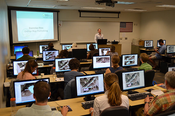
GIS for Public Gardens: Getting Started
May 20, 2013 - APGA Conference, Scottsdale Community College, Scottsdale, AZ
Creating and maintaining accurate collection maps are critical curatorial functions of public gardens that require experience with the latest geographic information system (GIS) technologies. This full-day workshop guided participants through the process of creating a GIS for a public garden using Esri ArcGIS software and the ArcGIS Public Garden Data Model. Participants learned how to use the data model template, how to create and edit map features in ArcGIS, how to collect data in the garden using a mobile device, and how to publish plant collection maps and applications online. They also learned some crucial concepts and background information about GIS, geodatabase data models, field data collection solutions, cartography, and the other Alliance resources available for creating a public garden GIS.
Workshop Materials
GIS for Public Gardens, Managed Landscapes and More: An Introductory Workshop
January 24 & 25, 2012 - Harvard University, Cambridge, MA
This full-day workshop guided participants through the process of creating GIS for a public garden or similar institution using Esri ArcGIS and the Alliance for Public Gardens GIS' ArcGIS Public Garden Data Model. Participants learned how to download and install the data model template, how to create and edit map features in ArcGIS, how to collect data in the garden using a mobile device, and how to create plant collection maps. Participants were also provided with crucial concepts and background information about GIS, managing and presenting garden collections data, and additional APGG support resources available for creating a public garden GIS for your own garden, park, nature center, zoo, cemetery, museum or public landscape.
Workshop Materials
- Agenda
- Presentation
- ArcGIS Public Garden Data Model Poster
- Arnold Arboretum Sample Data
- Exercise Data
GIS for Public Gardens: Getting Started
June 20, 2011 - Center for Public Horticulture, University of Delaware, Newark, DE
This full-day workshop guided participants through the process of creating GIS for a public garden or similar institution using Esri ArcGIS and the Alliance for Public Gardens GIS' ArcGIS Public Garden Data Model. Participants learned how to download and install the data model template, how to create and edit map features in ArcGIS, how to collect data in the garden using a mobile device, and how to create plant collection maps. Participants will also be provided with crucial concepts and background information about GIS, managing and presenting garden collections data, and additional APGG support resources available for creating a public garden GIS for your own garden, park, nature center, zoo, cemetery, museum or public landscape.
Workshop Materials
- Agenda
- Presentation
- ArcGIS Public Garden Data Model Poster
- Arnold Arboretum Sample Data
- ArcGIS Public Garden Data Model 1.0.2 Beta for ArcGIS 10
- Exercise Data
GIS for Public Gardens: Getting Started
October 23, 2010 - Center for Public Horticulture, University of Delaware, Newark, DE
This full-day workshop guided participants through the process of creating GIS for a public garden or similar institution using Esri ArcGIS and the Alliance for Public Gardens GIS' ArcGIS Public Garden Data Model. Participants learned how to download and install the data model template, how to create and edit map features in ArcGIS, how to collect data in the garden using a mobile device, and how to create plant collection maps. Participants will also be provided with crucial concepts and background information about GIS, managing and presenting garden collections data, and additional APGG support resources available for creating a public garden GIS for your own garden, park, nature center, zoo, cemetery, museum or public landscape. Workshop Review
Workshop Materials
- Agenda
- Presentation
- Missouri Botanical Garden Sample Data
- ArcGIS Public Garden Data Model 0.19
- Exercise Data
Implementing the ArcGIS Botanical Garden and Zoological Park Data Model
June 1, 2010 - APGA Conference, Omni Hotel at CNN Center, Atlanta GA
This workshop was part of a larger workshop title GIS Implementation for Botanic Gardens: Introductory and Intermediate topics, and provided participants with an overview of the GIS resources available through the Alliance for Public Gardens GIS and an introduction to GIS data models. It also provided them with an interactive demonstration on how to download, install, and get started using the pre-release version of the ArcGIS Botanical Garden & Zoological Park Data Model for managing living collections. Workshop Materials
Creating & Maintaining Accurate Collection Maps: The GIS & GPS Method
June 22, 2008 - APGA Conference, Huntington Botanical Garden, San Marino, CA
Creating and maintaining accurate collection maps are critical curatorial functions of public gardens that require significant experience with the latest technologies. This full-day workshop provided participants with an interactive introduction to collection mapping that features hands-on exercises using a combination of the industry's leading software and hardware. Participants were guided through the basics of working with Esri's ArcGIS software, using the ArcGIS Botanical Garden & Zoological Park Data Model standard, collecting data with a combination of Esri's ArcPad software, Trimble GPS receivers, and laser offset equipment, post-processing data with Trimble's GPS Analyst software, and creating collection maps with ArcGIS.
Workshop Materials