The ArcGIS Public Garden Data Model is being used by more and more gardens everyday to map, manage, and analyze their collections and assets.Below you will find brief descriptions of how the institutions that have contributed to the development of the data model have put it to work at their gardens.Check back in the coming months to see detailed stories on how our Beta Program partners have made the data model work for them.
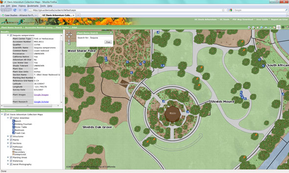
The UC Davis Arboretum is responsible for the design of the data model, and as a result has been using it to manage their collections the longest. They have used the model to map over 35,000 plants in their living collection and to produce a series of 35 detailed collection maps. The data model also serves as the foundation for an interactive GIS web application that allows staff, visitors, and researchers to search their collection and print custom maps. Recently, they have used the Tree Assessment Module to analyze the health of their trees. Collection Map|Web Application|Web Application Article
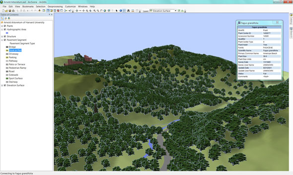
The Arnold Arboretum has been instrumental in testing and refining the data model, and has employed more of its features than any other garden. They are in the process of migrating their collection maps to the data model and are developing a two-way link between the model and BG-BASE. They also are the first institution to put the Collection Researcher web application to use. Web Application| Mobile Application| Mobile Application Article
UC Davis Arboretum
The UC Davis Arboretum is responsible for the design of the data model, and as a result has been using it to manage their collections the longest. They have used the model to map over 35,000 plants in their living collection and to produce a series of 35 detailed collection maps. The data model also serves as the foundation for an interactive GIS web application that allows staff, visitors, and researchers to search their collection and print custom maps. Recently, they have used the Tree Assessment Module to analyze the health of their trees. Collection Map|Web Application|Web Application Article
Arnold Arboretumof Harvard University
The Arnold Arboretum has been instrumental in testing and refining the data model, and has employed more of its features than any other garden. They are in the process of migrating their collection maps to the data model and are developing a two-way link between the model and BG-BASE. They also are the first institution to put the Collection Researcher web application to use. Web Application| Mobile Application| Mobile Application Article
Smithsonian Gardens
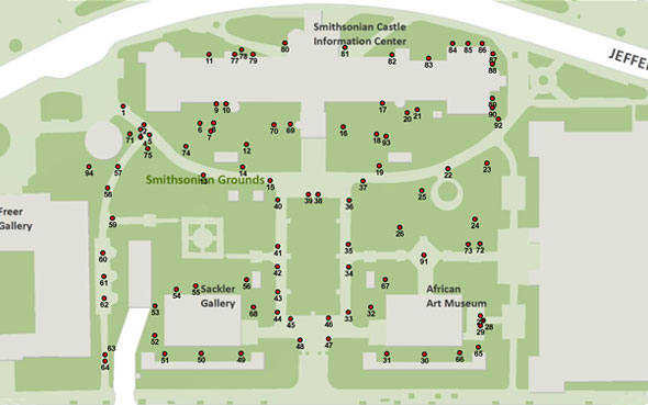
Smithsonian Gardens participated in our Beta Program as a partner, and is using the Basic Plant Records module to manage their tree inventory as well as the Facilities & Infrastructure module to model drainage for their mosquito suppression project as shown in the image to the right.