The ArcGIS Public Garden Data Model is the most powerful and efficient tool for creating a public garden GIS
It leverages the unparalleled features of Esri's ArcGIS software to allow you to create and collect data with mobile, desktop, and web-based solutions; to perform advanced spatial analysis; and to publish and share collection and asset information. Public gardens use the data model every day to edit and analyze their data in order to make more informed decisions, faster.
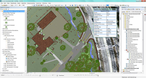
With the ArcGIS Public Garden Data Model you can:
- Start creating, importing, and collecting data quickly without the need to design your own GIS.
- Report on collection or asset data by a nearly limitless combination of locations and attributes.
- Use the included simple plant records system or link to an existing one.
- Link features to web pages, documents, media, or any other file on your network or the internet.
- Evaluate plant condition, hazards and benefits with included geoprocessing models.
- Create high quality map books with or without using your garden's grid system.
These are just a few of the ways the data model can make the management of your garden's collections and assets easier. Read our Case Studies to learn more about how public gardens are putting the model to use. Download and print the flyer to share this information with others.
Register & Download the Data Model